Home »
Studies
The Faculty of Geodesy and Cartography at Warsaw University of Technology is the oldest academic geodetic research and teaching institution in Poland. It was established in 1921 as the Faculty of Surveying. The current name of the Faculty of Geodesy and Cartography was adopted in 1954. Faculty graduates are esteemed engineers in Poland, valued in Europe, with a high professional and social position.
In the Faculty of Geodesy and Cartography you can study in the following fields of education:
| Field of study | Full-time studies | Part-time study | ||
|
First-cycle (Bachelor degree) 3.5 years |
Second-cycle (Master Degree) 1.5 years |
Third cycle (PhD) up to 4 years |
First-cycle (Bachelor degree) 4 years |
|
| Geodesy and Cartography | PL | PL / EN | PL | PL |
| Spatial Planning | PL | PL / EN | ||
| Geoinformatics | PL | |||
The Faculty of Geodesy and Cartography offers following courses:
1. Geodesy and Cartography courses in Polish
Geodesy is historically the science of surveying the Earth and presenting its image in the form of maps related to cartography. Modern geodesy and cartography is still the field of science related to surveying, but with the use of many observational techniques starting with geodesy and geodynamics through satellite and airborne photogrammetric imaging, remote sensing techniques to classic ground-based surveying and legal aspects of cadastral and property management. The variety of Earth observation techniques is constantly increasing the role of a surveyors and cartographers as those who can integrate all these data, providing precise spatial location and georeferenced and is able to present and interpret occurring phenomena.
Geodesy and Cartography – the First Cycle in Polish
general course in full-time studies
(pdf, 378.74 kB)
Geodesy and Cartography – the Second Cycle in Polish
7 specializations:
1. Geodesy and Satellite Navigation
(pdf, 226.95 kB)
2. Engineering and Industrial Surveying
(pdf, 377.48 kB)
3. Cadastre and Real Estate Management
(pdf, 254.85 kB)
4. Photogrammetry and Remote Sensing
(pdf, 316.76 kB)
5. Cartography and Geographic Information Systems
(pdf, 248.52 kB)
6. Spatial Information Systems
(pdf, 280.61 kB)
7. Mobile Mapping and Navigation Systems in English
Double diploma programme (Faculty of Geodesy and Cartography of the Warsaw University of Technology and School of Geodesy, Cartography and Surveying Engineering Universitat Politècnica de València)
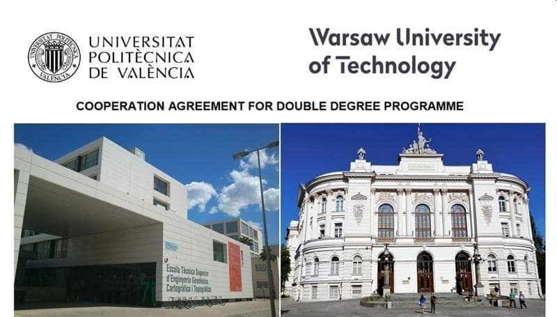
Signed double diploma agreement between the Faculty of Geodesy and Cartography of the Warsaw University of Technology and School of Geodesy, Cartography and Surveying Engineering Universitat Politècnica de València allows completing one study with student mobility, and to receive two university diplomas thanks to mutual recognition of learning outcomes and recognition of the high level of teaching in both universities.
The fields covered by the double diploma are:
- geodesy and cartography at the Warsaw University of Technology
- engineering geomatics and geoinformation at Universitat Politècnica de València
The initial schedule of study organization with the two-semester mobility and the recommended classes that should be included in the mobility agreement can be found in the annex
The double diploma agreement for the master's degree in geodesy and cartography of the Warsaw University of Technology covers all 7 specialities (including MMNS). Students do not pay tuition fees at the host university. They have full student rights while they are abroad. Interested students should have (at the time of departure):
- completed first-cycle studies in the field of geodesy and cartography, spatial planning, or geoinformatics with at least 210 ECTS,
- completed 2 semesters of the second-cycle studies in the field of geodesy and cartography, having at least 60 ECTS,
- knowledge of English at least B2 level,
- knowledge of Spanish at least B1.
Candidates for mobility to UPV will be nominated from the Faculty of Geodesy and Cartography. every semester. Nomination for participation in the double diploma program should be submitted by April 30 for Polish-taught studies attendees and by October 30 for English-taught studies attendees. At the same time, the student should be admitted during the March (and October) admission for the Erasmus+ program to get the scholarship.
Double diploma programme (Faculty of Geodesy and Cartography of the Warsaw University of Technology and Institute of Geodesy National University Lviv Polytechnic)
Signed double diploma agreement between the Faculty of Geodesy and Cartography of the Warsaw University of Technology and Institute of Geodesy National University Lviv Polytechnic allows completing one study with student mobility, and to receive two university diplomas thanks to mutual recognition of learning outcomes and recognition of the high level of teaching in both universities.
The fields covered by the double diploma are:
- geodesy and cartography at the Warsaw University of Technology
- geodesy and land management at the National University Lviv Polytechnic
The double diploma includes 3 semesters of studies, 1 takes place at the Lviv Polytechnic, including distance learning, and 2 take place at the Warsaw University of Technology. The study program is implemented through an individual study plan taking into account the learning outcomes of both fields and specializations of studies. It includes at least 120 ECTS, including professional internships and the implementation of a joint diploma thesis.
The preliminary schedule for organizing studies, taking into account two-semester mobility, is included in Annex 1.1.
The program agreement form can be found in the attached Learning Agreement template.
The double diploma agreement for the master's degree in geodesy and cartography at WUT covers all 7 specialties. Students do not pay fees for studies at the host university. They have full student rights during mobility. Interested students should have at the time of departure (not recruitment):
- completed 1 semester of second-cycle studies in the field of geodesy and cartography, at least 60 ECTS (WUT students), or the field of geodesy and land management (NUPL students)
- knowledge of English at least B2 level or knowledge of Polish language at least B1 level (NULP students), knowledge of English language at least B2 level or knowledge of Ukrainian language at least B1 level (WUT students)
Candidates for the program are selected every semester at WUT by April 30 for students of Polish-taught studies and by October 30 for students of English-taught studies, and once a year at NULP by October 30.
For more information, please get in touch with the Commission for International Educational Programs chair dr Pluto-Kossakowska joanna.kossakowska@pw.edu.pl
2. Spatial Planning courses in Polish
Spatial Planning is the field of study addressed to all who: want to understand the technical, social, economic and legal aspects of the process of spatial management policy at the local (municipal), regional, national level, and on a European and global scale. It is dedicated for who are interested in acquiring knowledge and practical skills related to urban design, environmental impact assessment, ecophysiographic studies, activities related to landscape revitalisation and protection, and real estate management. Students of Spatial Planning learn about modern tools and instruments as well as software supporting analysis and design processes, i.e. CAD, GIS, BIM and are interested in acquiring the necessary knowledge to comprehensively look at the complex issue of rational spatial management, and acquiring practical skills highly valued on the labour market.
Spatial Planning Planning – the First Cycle in Polish
2 specialitzations:
1. Urban Design in Spatial Planning
(pdf, 319.55 kB)
2. Environmental Conditions in Spatial Planning
(pdf, 329.62 kB)
Spatial Planning – the Second Cycle in Polish
2 specialitzations:
1. Urban Design in Spatial Planning
(pdf, 253.01 kB)
2. Environmental Conditions in Spatial Planning
(pdf, 252.41 kB)
3. Smart Environmental Planning and Design in English
3. Geoinformatics course in Polish
Geoinformatics is the field of preparing systems based on spatial information and creating innovative geoinformation products: digital maps, spatial models of objects (e.g. three-dimensional models of cities), geoportals, location and navigation applications, programs automating the acquisition of data about the Earth's surface. It is also data that comes from pollution sensors or microchips monitoring the movement of wild animals. The analysis of the labour market shows that the demand for specialists combining knowledge and skills in the field of IT and broad understanding of geoinformation sciences is growing. The graduate will be able to design, perform and participate in the creation of software and systems supporting the work of specialists acquiring, processing and using geographical information (e.g. telecommunications, energy, banking and insurance, geomarketing, security and defense, tourism, logistics and transport, environmental protection, spatial planning, geology, forestry).
Geoinformatics – the First Cycle in Polish
(pdf, 326.54 kB)
4. Postgraduate courses (in Polish):
- Real Estate Valuation,
- Real Estate Management,
- Spatial Information Systems,
- Rural Development,
- Spatial Planning in practice
